
Landsat
The longest continuous space-based record of Earth's land surface.
Agency
NASA · USGS
Destination
Earth (land surface)
Launched
July 23, 1972
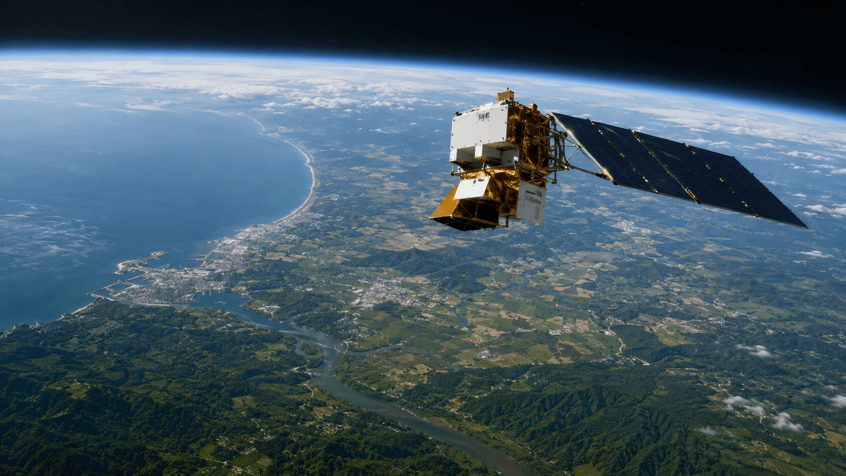
Quick answer: Landsat is an Earth-observation satellite program led by NASA and USGS. It began on July 23, 1972, focused on Earth's land surface, and is best known as the longest continuous space-based record of Earth's land surface. Its work documents land cover, crops, forests, water, cities, disasters, glaciers and environmental change across decades.
Landsat at a Glance
| Question | Answer |
|---|---|
| What kind of mission is it? | Earth-observation satellite program |
| Who leads it? | NASA and USGS |
| When did it begin? | July 23, 1972 |
| What does it study? | Earth's land surface |
| Current or final status | Active |
| Why is it famous? | Longest continuous space-based record of Earth's land surface |
What Is Landsat?
Landsat is the joint NASA–USGS Earth-observation satellite program. It began on July 23, 1972 with the launch of Landsat 1 (originally called ERTS-1) and continues today with Landsat 8 and Landsat 9. It documents Earth's land cover, crops, forests, water, cities, disasters, glaciers and environmental change across more than five decades.
Why Landsat Was Created
Before Landsat, most Earth observation from space was classified or short-lived. Mission planners chose a civil program with open data — a policy that later reshaped the entire Earth-observation field. Successive Landsat satellites carry calibrated multispectral and thermal-imaging instruments compatible with earlier data, enabling long time series.
Landsat Facts at a Glance
| Field | Value |
|---|---|
| Program purpose | Continuous multispectral and thermal imaging of Earth's land surface |
| Launch | July 23, 1972 |
| Flight strategy | Continuing series of calibrated multispectral and thermal-imaging satellites |
| Mission status | Active |
| Defining importance | Longest continuous space-based record of Earth's land surface |
Launch, Route, and Arrival
Each Landsat satellite orbits Earth in a sun-synchronous polar orbit, allowing consistent lighting for surface imaging. The program has spanned nine flight vehicles to date, each providing overlapping calibration with predecessors.
Spacecraft Design and Instruments
Landsat spacecraft carry multispectral and thermal-imaging instruments matched across generations. Landsat 8 and 9 carry the Operational Land Imager (OLI) and Thermal Infrared Sensor (TIRS). Every subsystem supports repeated global imaging with consistent geometry, radiometry and archiving.
How the Mission Collects Evidence
Instruments are calibrated in the lab and cross-checked against overlapping satellites and ground targets. Data are archived openly through USGS EarthExplorer, allowing scientists worldwide to reproduce or challenge results.
Major Discoveries
Landsat documents land cover, crops, forests, water, cities, disasters, glaciers and environmental change across decades. Its archive underpins agricultural monitoring, deforestation tracking, water-resource management, wildfire assessment, urban growth analysis and climate research.
Engineering Challenges
The Earth-orbit environment imposes constraints on radiation, atomic oxygen erosion, atmospheric drag, thermal cycling and communications. Long-lived calibration matters as much as raw performance because science depends on comparing images taken years apart.
People and International Cooperation
Landsat is a shared U.S. civil program with NASA responsible for spacecraft development and USGS responsible for operations and archiving. International ground stations, science teams and downstream product providers extend its reach worldwide.
How Landsat Changed Earth Science
The longest continuous space-based record of Earth's land surface enables research that no shorter dataset could support. It complements atmospheric platforms and, at a very different scale, the International Space Station.
What Landsat Does Not Prove
Landsat's spatial resolution and revisit time have limits. Finer detail requires higher-resolution commercial or airborne data; some processes require radar or hyperspectral instruments.
Frequently Asked Questions About Landsat
What is the main purpose of Landsat?
To provide continuous multispectral and thermal imaging of Earth's land surface for scientific and applied use.
When did Landsat begin?
The program began on July 23, 1972 and continues today.
Who operates Landsat?
NASA and USGS jointly operate the program.
What has Landsat discovered?
It documents land cover, crops, forests, water, cities, disasters, glaciers and environmental change across decades.
Why is Landsat historically important?
Because it is the longest continuous space-based record of Earth's land surface.
Is Landsat still active?
Yes. Landsat 8 and Landsat 9 continue to operate.
How does Landsat image Earth?
Using a continuing series of calibrated multispectral and thermal-imaging satellites in sun-synchronous polar orbits.
Where can Landsat data be found?
Start with the official USGS Landsat portal.
Final Perspective
Landsat is the reference dataset for Earth's changing land surface. Its defining place — the longest continuous space-based record of Earth's land surface — anchors decades of research and continues today.
Authoritative Source
Factual status reviewed: September 4, 2026.
Primary sources
Last verified 2026-01-15. Mission status and dates can change.